Introduction
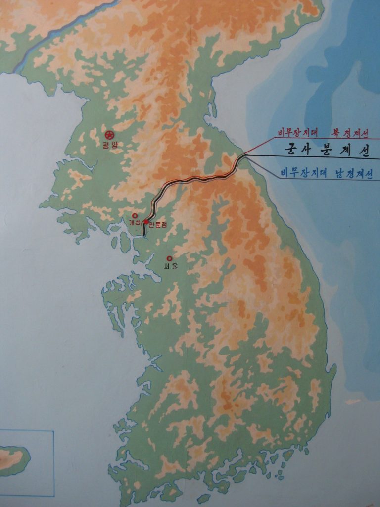
The DMZ, or Korean Demilitarised Zone is an area of land cutting across the Korean Peninsula and serves as both the buffer zone and de facto border between North Korea and South Korea. The DMZ stretches 250 kilometres (160 miles) along the 38th parallel which almost equally divides the Korean Peninsula in half with North Korea (DPRK) on the northern side, and South Korea (ROK) on the southern.
The DMZ is the most fortified border in the world with over 2 million active military soldiers constantly patrolling both sides of the border 24/7. Former US President Bill Clinton called the DMZ “the scariest place on earth” during his official visit on the southern side back in 1993.
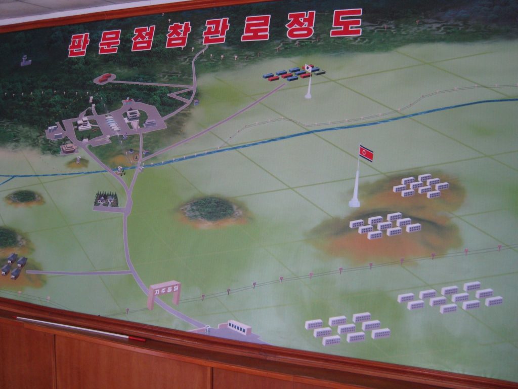
Located within the DMZ is Panmunjom and the Joint Security Area (JSA), a small village consisting of blue huts which belong to the UN and silver huts belonging to North Korea. Panmunjom and the DMZ are located 8 kilometres nearby the city of Kaesong in North Hwanghae province and is possible for tourists in North Korea to visit the DMZ with less restrictions than tourists visiting from the south.
Table of Contents
- History of the DMZ & Panmunjom
- Joint Security Area (JSA)
- The Concrete Wall – DMZ
- How to visit the DMZ
- Regulations when visiting Panmunjom
- Kaesong Industrial Zone
History of the DMZ & Panmunjom
The DMZ was first created along the 38th parallel by the United States backing South Korea and the Soviet forces backing North Korea at the end of Japanese Occupation of Korea and World War II in 1945. This was to separate the two current super powers of the world.
In 1950, the Korean War broke out and during 1951 to 1953 Panmunjom, also known as the Truce Village was used as the area where peace negotiations could safely take place within this unique section of the DMZ. In 1953, the Korean Armistice Agreement was signed to end hostilities between the UN forces and the joint communist forces of North Korea and China.
The signed agreement introduced new regulations to the Military Demarcation Line (MDL) which is the actual border between North and South Korea. Apart of these regulations include both sides relocating their military back 2 kilometres (1.2 miles) from the MDL creating a 4 kilometre (2.5 miles) buffer zone also known as ‘Korea’s no man’s land’ or ‘kill zone’ at the DMZ.
The MDL line drawn saw a shift in territory as a result of the Korean War with Sokcho city on the east coast of the peninsula previously belonging to North Korea now under South Korean control, and Kaesong city on the west of the peninsula previously under South Korean control now belonging to North Korea.
As well as the overland border, an ocean border was defined and known as the Northern Limit Line. The exact line is still disputed today due to a disagreement between the UN and the DPRK over exact distances.
The DMZ is also noticeably famous for being an area where wildlife thrives and are protected. More than 5,000 species of plants and animals have been identified within the buffer zone, including more than 100 that are listed as near-threatened or endangered such as the Asiatic black bear, Red-crowned crane, White-naped crane, cinereous vulture, Siberian musk deer, and a distinct species of wild goat.
Joint Security Area (JSA)
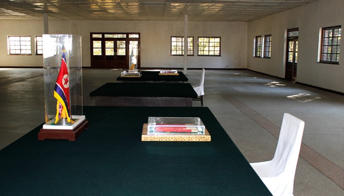
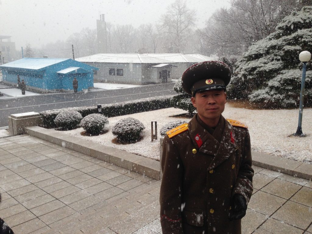
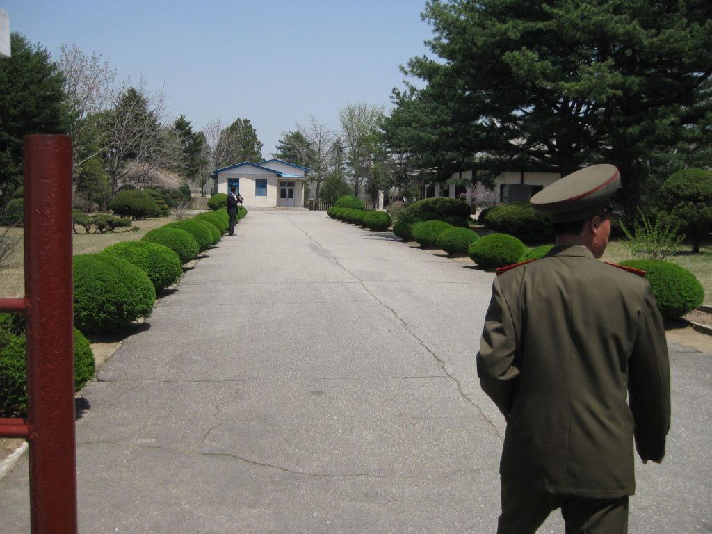
Panmunjom is located north of the Military Demarcation Line and is within North Korean territory. These days, Panmunjom has become the Peace Museum where tourists in North Korea visit the exact location where the armistice agreement was signed whilst they tour the nearby Joint Security Area (JSA).
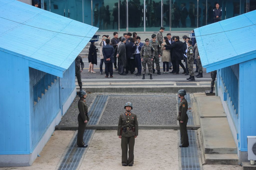
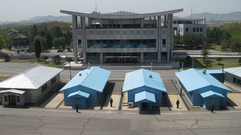
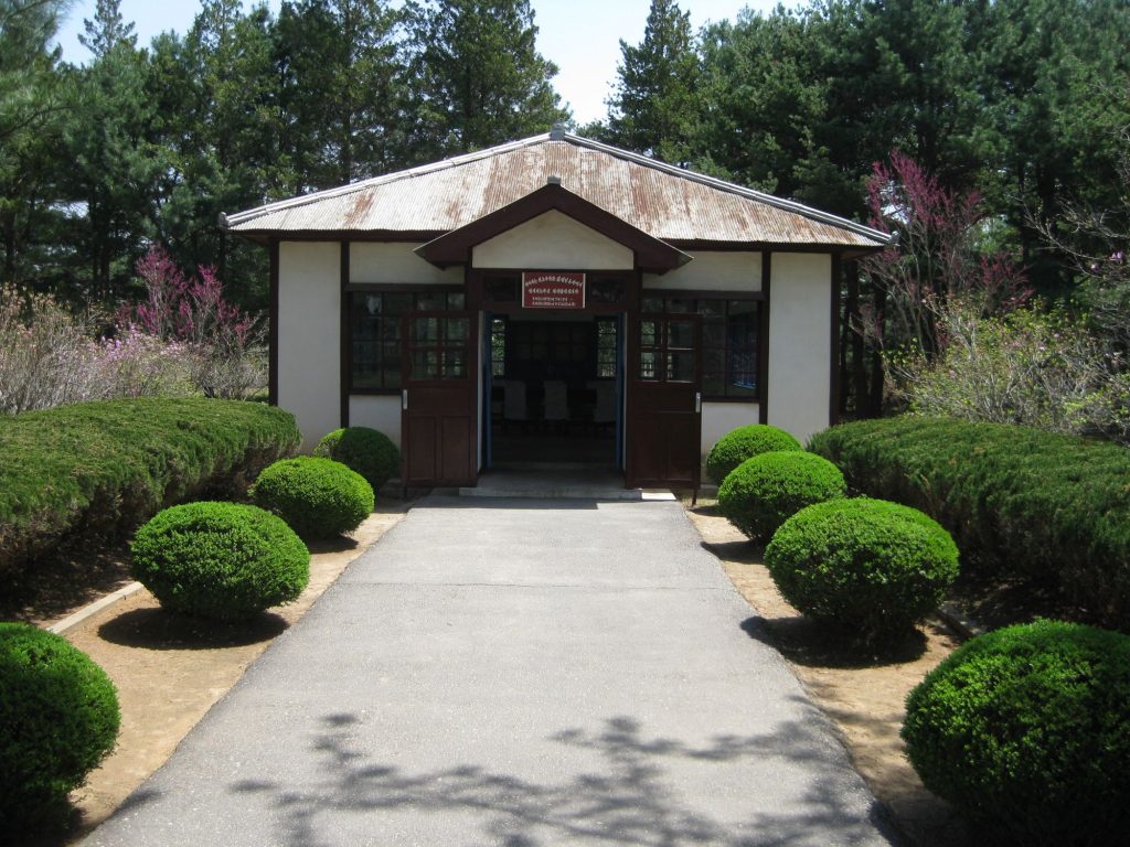
The JSA, previously known as the Conference Hall to North Koreans is located at Panmunjom and is the most famous area of the DMZ that has grown in popularity since the Korean War.
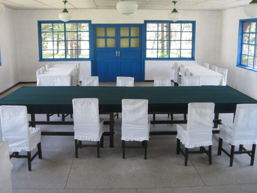
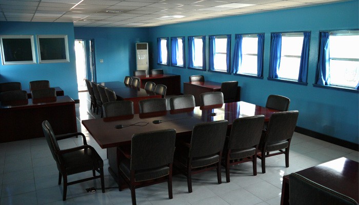
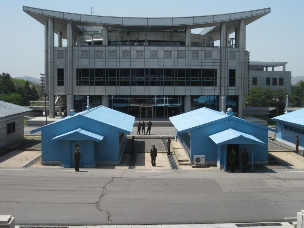
The distinctive blue huts and silver conference buildings straddle the Military Demarcation Line and is the site where ongoing negotiations and diplomatic talks between North and South take place. It’s possible to enter one of the blue huts as a tourist and view the conference table placed directly over the border line, with the microphone cables strategically running along the middle of the table marking the international border.
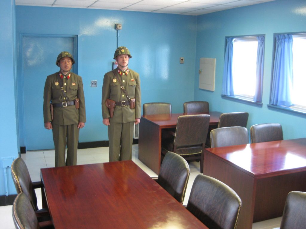
Once entering the blue hut North Korean soldiers stand at the South Korean entrance to prevent you from illegally exiting the hut and entering South Korea. You are free to wander inside the hut which is technically the only place in the world where you can cross between North and South Korea.
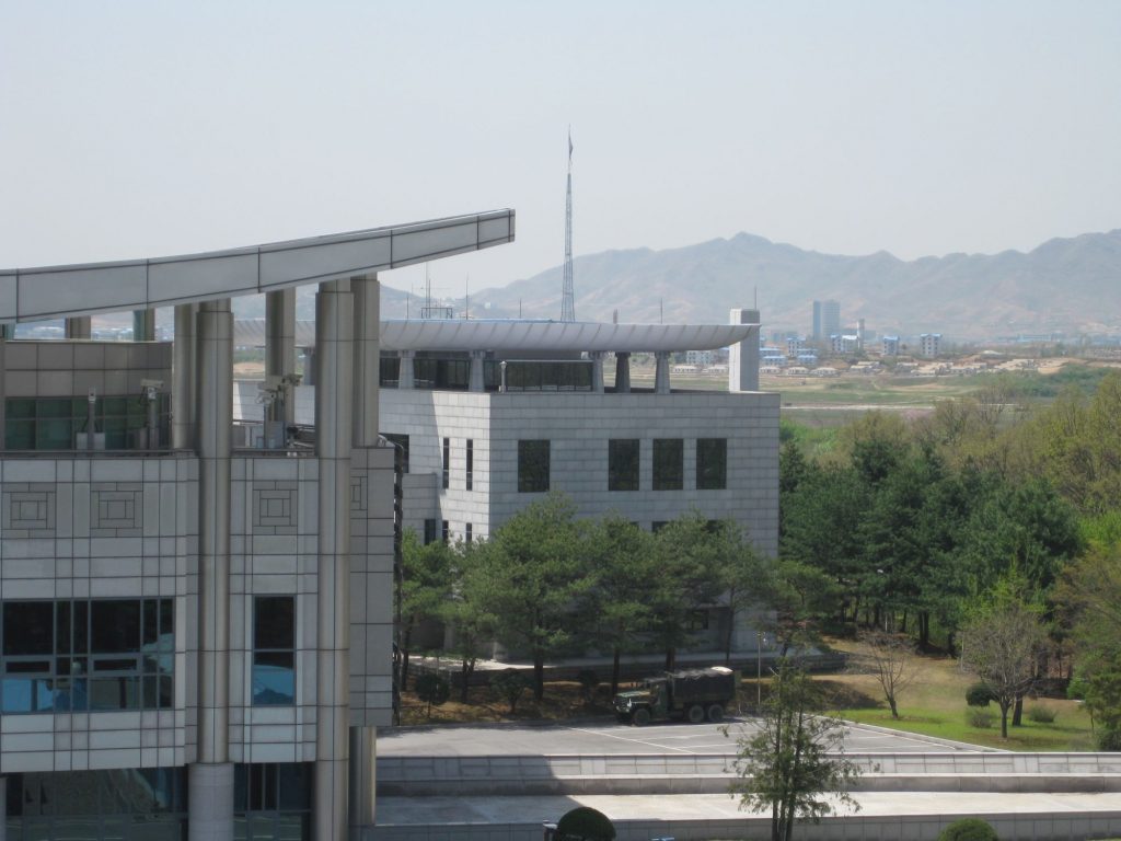
The largest building on North Korea’s side is called Panmungak and is 80 meters directly opposite South Korea’s largest building named the House of Freedom. Located behind the House of Freedom is Peace House. Numerous guard posts and observation towers with CCTV monitoring 24/7 are situated on both sides of the DML.
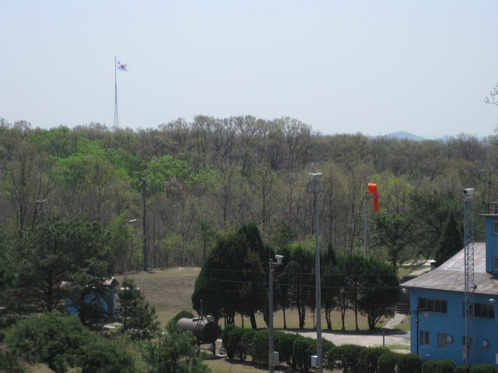
From standing on the balcony of Panmungak, two huge flag towers can be seen. One being the North Korean flag and the other the flag of South Korea. Both Koreas went through a brief flag war during the 1980s to have the tallest flag pole. The result was the North Koreans winning with their 160 meters flag pole displaying a 30 metre by 60 metre flag in Kijong-dong ‘Peace Village’. Currently the fourth tallest in the world. South Korea’s is 98 meters tall and located in Taesong-dong village.
Until 1976, the JSA had both UN forces and North Korean forces spread equally around the whole area. However, the ‘Axe Murder Incident’ saw US military soldiers attempt to cut down a contested tree which was blocking the view of a UN guard post and gave an advantage to numerous North Korean posts. This incidence led to a fight which resulted in casualties. The axe is on display in Panmunjom for tourists in North Korea to view. The stump of the tree is displayed on the south side.
It was then concluded from this event that each side would relocate and restrict their guard posts to either side of the MDL to avoid any further possible conflict.
The Concrete Wall – DMZ
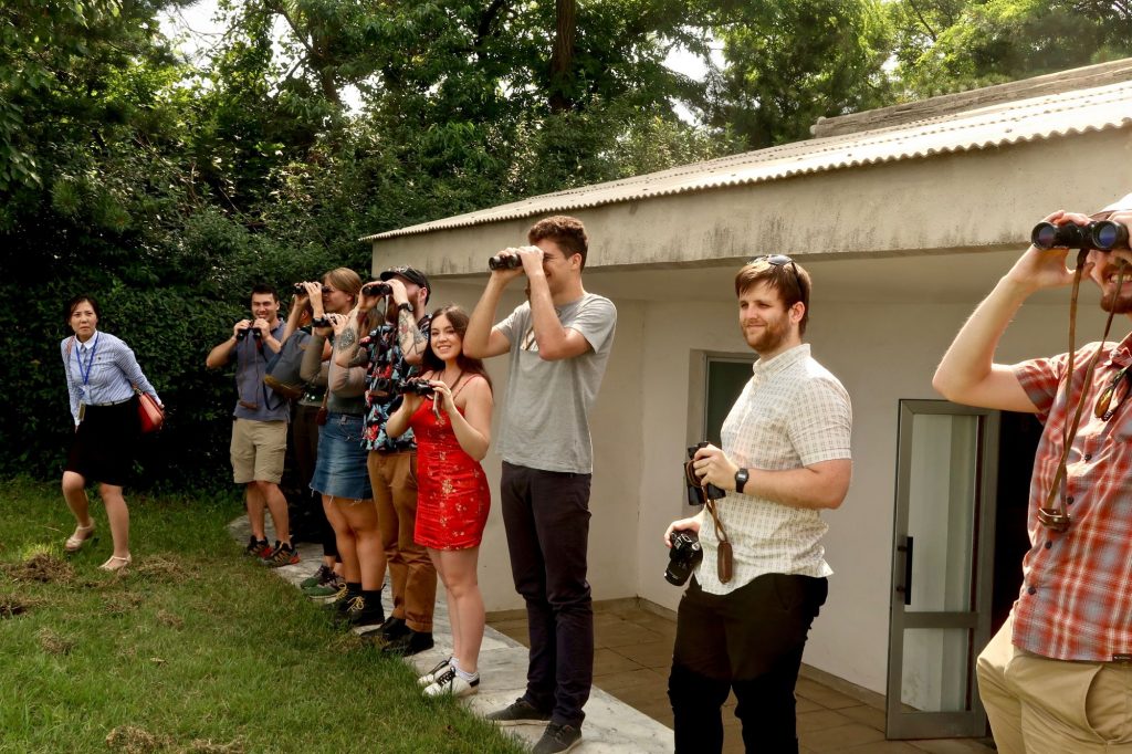
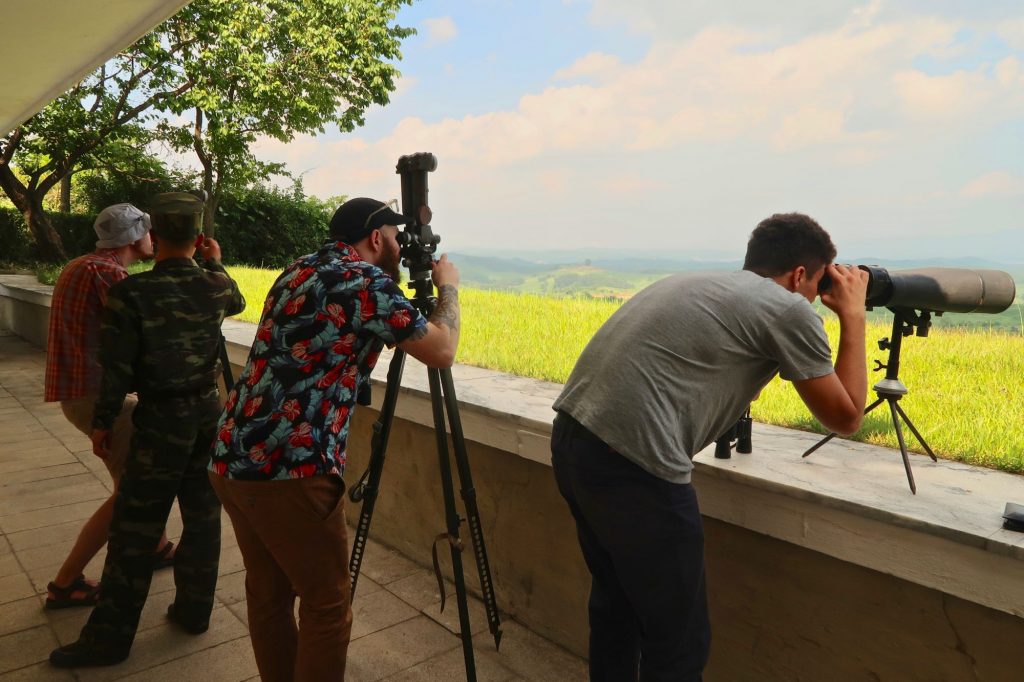
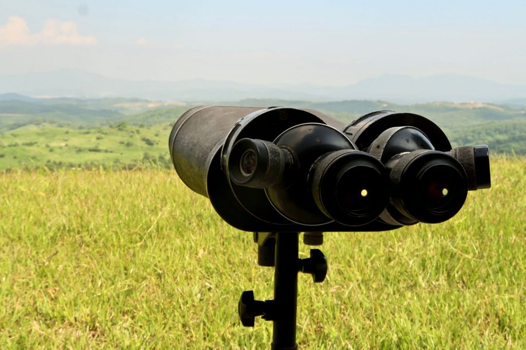
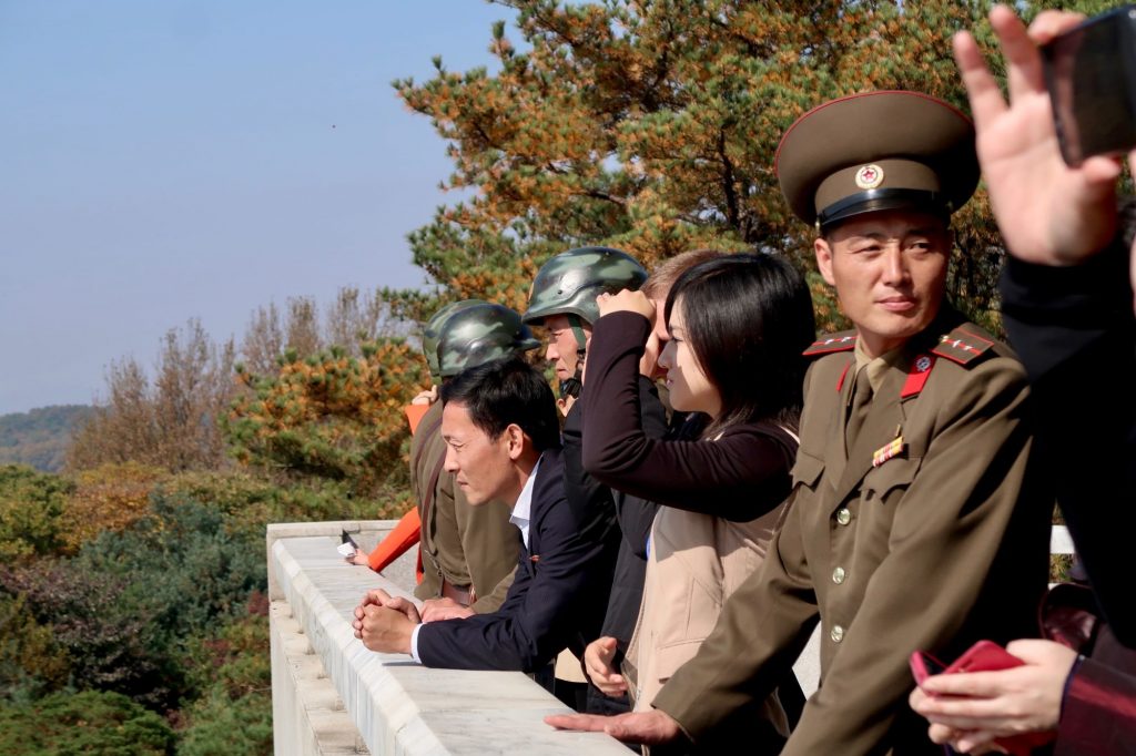
The Concrete Wall, also known as the Korean Wall is located 28 kilometres further west along the DMZ from Panmunjom is a DPRK military lookout post formally known as the Concrete Wall. It is possible for tourists to visit this active guard post alongside a North Korean Colonel to view through binoculars multiple South Korean/UN military guard posts, military installations, a South Korean town and the controversial concrete wall.
The concrete wall was constructed by the South Korean government from 1976 to 1979. The wall is built onto a slope standing 9 metres tall, 19 meters thick and runs 240km along the DMZ. From the South Korean side, you only see a mound, from the North Korean side the wall is visible. This is viewed by the North as a permanent divide to both nations, something the South hasn’t been quite open about. In this respects the North Koreans see the Korean wall as akin to the Berlin Wall.
How to visit the DMZ
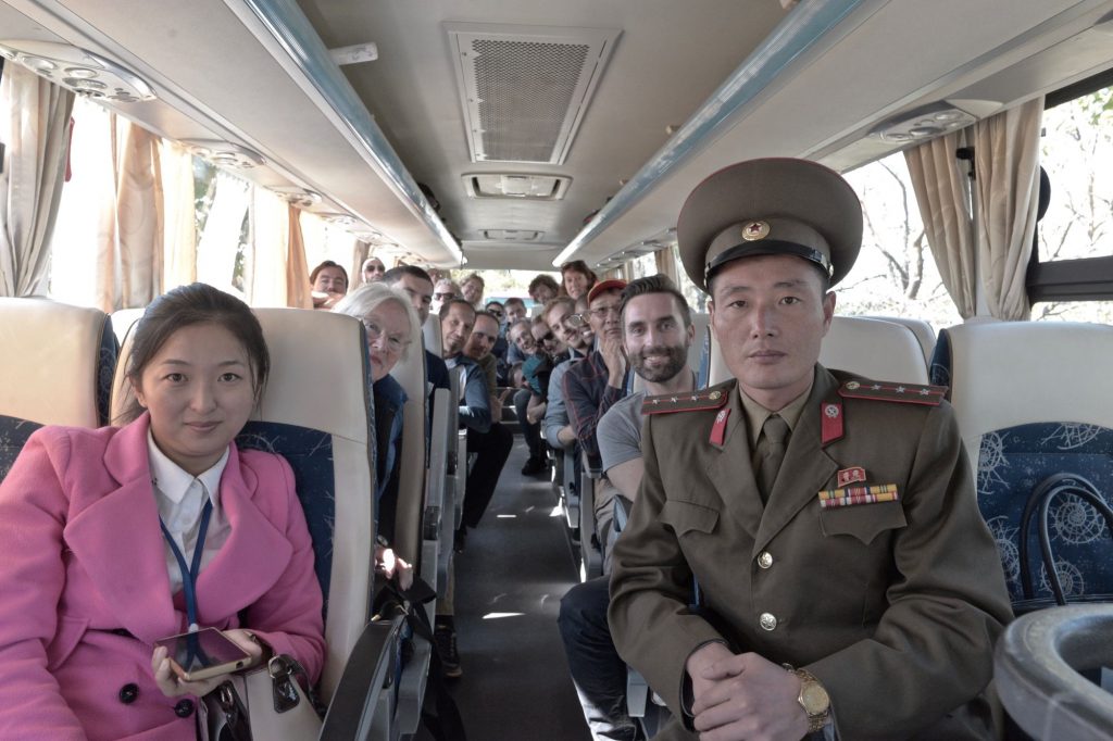
Tourists in North Korea are able to visit or see the DMZ from multiple points such as Mt. Kumgang or from Haeju city. Tourists wanting to explore Panmunjom and the JSA are able to do so directly from Pyongyang. We include the DMZ in the majority of our tours. The drive between the capital city and the DMZ is 2 – 3 hours along the Reunification Highway completed in 1992.
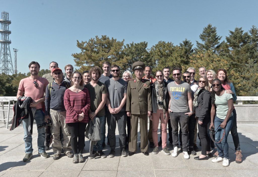
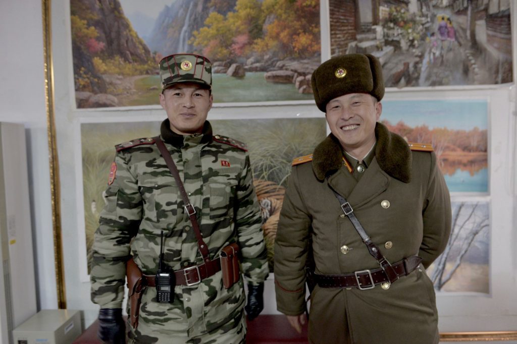
Once arriving at the DMZ, you will meet your local Korean People’s Army officer to be your local guide. Before being debriefed on the history of Panmunjom, there is a gift shop to explore that is most famous for selling hand painted propaganda posters from 250RMB or 30 euros – one of our favourite souvenir recommendations when visiting North Korea.
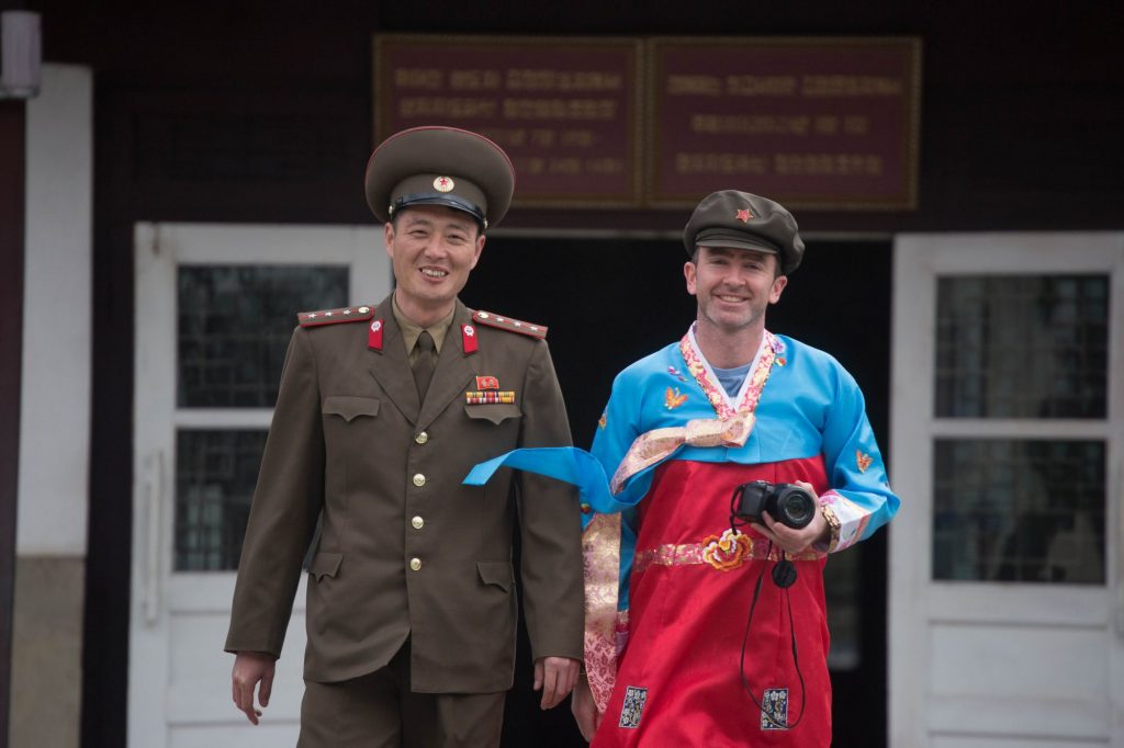
You will then enter the buffer zone with an extra KPA officer to ensure your safety. The second stop is the Peace Museum previously used by North Korean and UN officials to negotiate and sign the Korean Armistice Agreement.
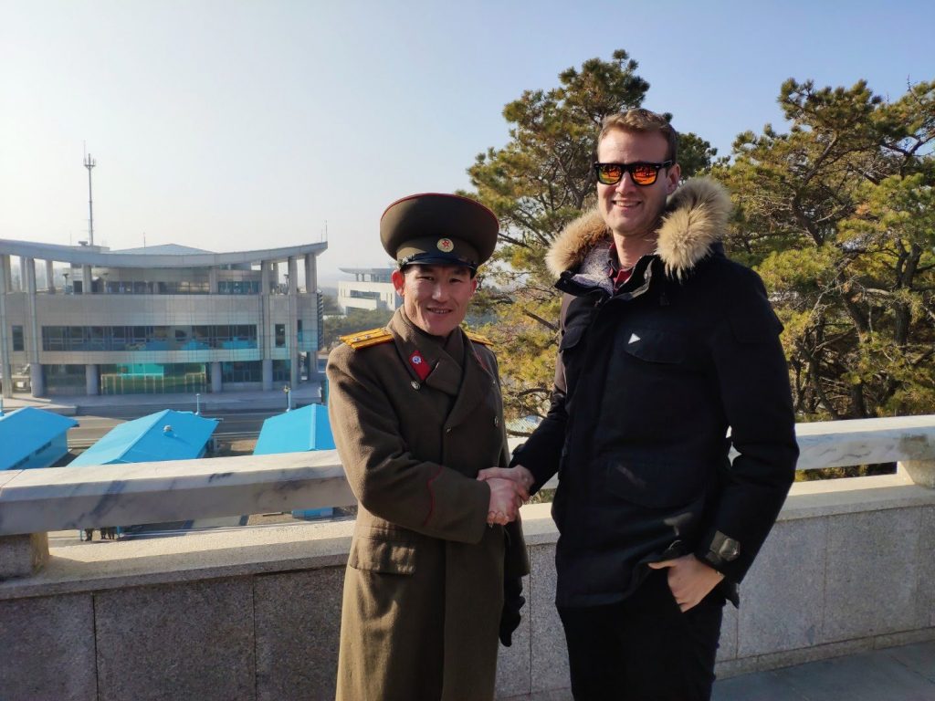
The third and final stop is arriving at the JSA. Your vehicle will be parked behind Panmungak and you’ll be walked to a huge marble monument with Kim Il Sung’s signature engraved on it. This signifies the copy of the signature he wrote on his final document before his death in July 1994.
You will then be escorted by foot down to the JSA to possibly enter the blue hut technically placing you in both Koreas on top of the military demarcation line. Here you will hear further explanations of the conference rooms. You will then be escorted to the balcony on top of Panmungak to view the surrounding area for further explanations and to have your very own photo with North Korean soldiers.
Regulations when visiting Panmunjom
There are a few regulations when visiting the DMZ but no where near as strict as visiting on the southern side. There are no clothing restrictions but please note to wear light clothing during summer and warm gear during winter.
Photography is generally allowed around Panmunjom and of the soldiers, but before entering the buffer zone no photos are allowed. When driving along the Reunification Highway you will pass multiple military checkpoints, there are strictly no photos allowed.
It is not possible to cross the DMZ as a tourist between North and South Korea.
Kaesong Industrial Zone
The Kaesong Industrial Complex located only a few kilometers away from Panmunjom is the special economic zone developed by Hyundai Asan in cooperation with the North Korean government. The complex opened in 2002 and allowed over 50,000 North Korean factory workers to work within over 100 different South Korean companies for 20% of a South Korean minimum wage.
In April 2013, North Korea recalled all North Korean workers from the complex ceasing all operations due to political issues. It reopened in August but was closed again in 2016 by the South former South Korean President Park Guen-hye. The South Korean administration accused the money used to pay the North Korean workers was used for financing North Korea’s nuclear program.
The current South Korean leader Moon Jae-in has signaled his desire to “reopen and expand” the joint industrial zone. It remains closed to this day.