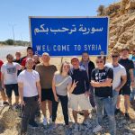
It’s been over thirty years since the fall of the Berlin Wall. The symbolic destruction of the concrete line that split the German capital in two since 1961 signalled a time of change. However, across the world today there are still cities cut in two and divided into sectarian lines. Naturally, we go to all of them. In today’s article, we’re going to give the rundown on the three most prominent divided cities in the world today.
Belfast, Northern Ireland

Belfast is an industrial port city in the United Kingdom or in Ireland, depending on who you ask. From 1969 to 1999 the city was gripped in a conflict known as ‘The Troubles’ which saw violent sectarian conflict rage between Catholic nationalists and protestant unionists. In the middle, the British Army was sent in during one of the biggest deployments in British history.
In an attempt to stop the carnage that eventually killed over 3,000 people, the British government installed ‘peace walls’ that cut through Belfast to keep Catholic and Protestant communities from killing each other. The walls required constant upgrading and lengthening, eventually becoming longer and higher than the Berlin Wall.
The stated purpose of the peace lines is to minimize inter-communal violence between Catholics (most of whom are nationalists who self-identify as Irish) and Protestants (most of whom are unionists who self-identify as British).
The peace lines range in length from a few hundred yards to over three miles (5 km). They may be made of iron, brick, and/or steel and are up to 25 feet (8 meters) high. Some have gates in them (sometimes staffed by security forces) that allow passage during daylight but are closed at night.
The majority of peace walls are located in Belfast but also exist in other Northern Irish cities such as Derry, Portadown, and Lurgan. They’ve since become a hub for political and anti-war graffiti.
Hebron, Israel
Hebron is a mostly Palestinian city and the largest city in the West Bank around 20 miles south of Jerusalem. Nestled in the Judaean Mountains, it lies 930 meters (3,050 ft) above sea level.
The city is of vital importance to all three major religions. Jews, Christians, and Muslims all venerate Hebron for its association with Abraham as it is home to the Cave of the Patriarchs, which according to tradition is the burial site of the Patriarchs and Matriarchs. Judaism ranks Hebron the second-holiest city after Jerusalem, while Muslims regard it as one of the four holy cities.
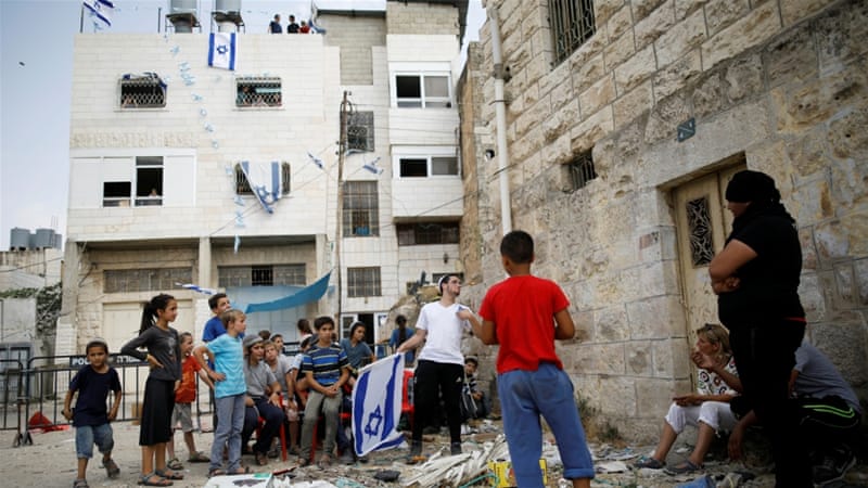
Hebron has a population of 215,452 Palestinians and between 500 and 850 Jewish settlers concentrated on the outskirts of the Old City of Hebron. Between the settlers and the Palestinians, a buffer zone and wall manned by a huge force of IDF troops keep the two sides apart.
The city is often described as a “microcosm” of the Israeli occupation of the West Bank. In 1997, The Hebron Protocol divided the city into two sectors: H1, controlled by the Palestinian Authority, and H2, roughly 20% of the city, administered by Israel. All security arrangements and travel permits for local residents are coordinated between the Palestinian Authority and Israel via the military administration of the West Bank, officially named Coordinator of Government Activities in the Territories (COGAT). The Jewish settlers have their own governing municipal body, the Committee of the Jewish Community of Hebron.
Hebron is defined by continuous violence between the two sides and remains a deeply divided city that is characteristic of the Arab-Israeli conflict. We explore both sectors of Hebron on a dual narrative tour on our Israel and Palestine trips.
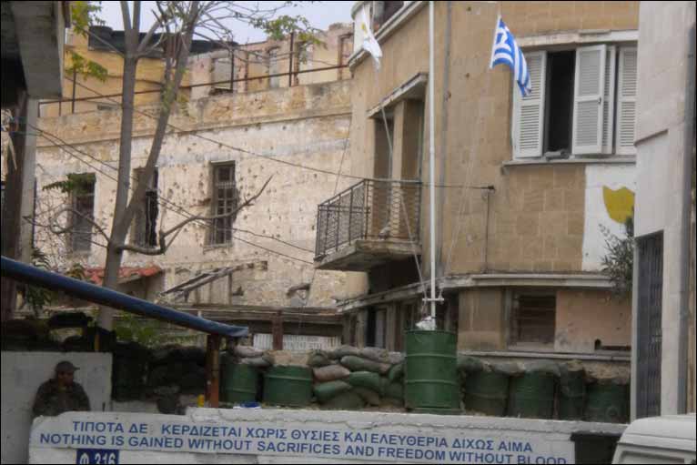
Nicosia, Cyprus
In the summer of 1974, the sleepy island of Cyprus was gripped by a coup carried out by the Cypriot National Guard who installed a military Junta with the aim of forming a union with Greece and turning the island into the Hellenic Republic of Cyprus.
In response, Cyprus was invaded by the Turkish military under the codename Operation Atilla. The invasion was claimed to prevent the ethnic cleansing of Turkish Cypriots. The Greek military junta collapsed and by August 1974, around 37% of Cyprus was now in Turkish hands and a ceasefire was declared.
The ceasefire line cut through the capital of Nicosia and became the UN Buffer Zone between Cypriot and Turkish sides. Today it’s called the Green Line. The war killed and displaced hundreds of thousands and both sides remain in a standoff to this day. Today, the Turkish Republic of Northern Cyprus is only recognized as a country by Turkey.
Nicosia remains the only truly divided capital city on earth today. You can visit it on our upcoming Divided Cyprus trip.