Introduction

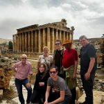
The island of Hwanggumpyong Island has garnered a lot of interest over the years as it was supposed to be turned into a tourist SEZ in the Yalu between Dandong and Sinuiju.
This has yet to come to pass, but it highlights the strange world of the many islands that North Korea owns, both between its river borders with China and its hotly disputed maritime border with the Republic of Korea.
We decided to look into these islands, and most things with North Korea it has proved both interesting and a little strange.
Islands Between North Korea and China
Following the partition of Korea and Chinese help during the Korean War, things were rather cordial between North Korea and China, so they set about deciding on who got what islands.
It was decided in a rather grown-up manner that rather than judge an island by geography, they would decide it by the majority of population. Therefore an island could be “in” China, but if it had a Korean population would be given to North Korea, and the same visa versa.
This has led to some weird anomalies, such as the aforementioned Hwanggumpyong Island.
Islands between North Korean and South Korea
Relations were not all that great following the Korean war, as you might imagine. The maritime border between the DPRK and ROK has never been fully fixed, which has led to incidents such as Yongpyong. There is a Maritime Demarcation Line (MDL) That is largely followed.
How Many Islands Does North Korea Have?
On the Tumen and Yalu rivers, there are 468 islands. North Korea has 280, China 187, and Russia a measly 1!
It is unknown exactly how many islands under DPRK control off of its coastline, but it would probably add a few more hundred, with very few of them being populated, particularly on the border with South Korea.
List of Main North Korean Islands
This is a list of main North Korean Islands split by region, but excluding less important islets and rocks.
Kangwon Province
- Hwangt’odo (Hangul: 황토도: 黃土島) (Jurisdiction: Anbyŏn County)
- Kukto (국도 Gukdo; 國島) (T’ongch’ŏn County)
- Samdo (삼도; 三島) (T’ongch’ŏn County)
- Sindo (신도; 薪島) (Wŏnsan City)
- Songdo (송도; 松島) (Kosŏng County)
- Yŏdo (여도 Yeodo; 麗島) (Wŏnsan City)
North Hamgyong and Rason Special City
- Chŏkto (적도 Jeokdo; 赤島) (Kyŏnghŭng County)
- P’ido (피도Pido; 避島) (Kyŏnghŭng County) Nando
- (난도; 卵島) (Sŏnbong County)
- Soch’odo (소초도 Sochodo; 小草島) (Rajin, Rason Special City)
- Ssangdo (쌍도; 雙島) (Rajin, Rason Special City)
- Taech’odo (대초도 Daechodo; 大草島) (Rajin, Rason Special City)
- Yangdo (양도; 洋島) (Kilju County)
Tumen River islands
- K’ŭnsŏm (큰섬 Keunseom) (Rason Special City)
- Maegido (매기도; 每基島) (Kyŏngwŏn County)
- Ryudado (류다도; 柳多島) (Kyŏngwŏn County)
North Pyongan Province
- Pansŏng Archipelago (Pansŏngnyŏldo; 반성렬도 [반성열도 Banseongyeoldo]; 盤城列島)
- Ka Island (가도 Ka-to or Gado; 椵島) (Ch’ŏlsan County)
- Rapto (랍도 [납도 Napdo]; 蠟島) (Ch’ŏlsan County)
- Samch’ado (삼차도 Samchado; 參瑳島) (Ch’ŏlsan County)
- Sinmi Island (신미도 Sinmi-to or Sinmi-do; 身彌島) (Sŏnch’ŏn County), the largest island in North Korea
- Sohwado (소화도; 小和島) (Ch’ŏlsan County)
- Sorapto (소랍도 Sorapdo; 小蠟島) (Ch’ŏlsan County)
- Taehwado (대화도 Daehwado; 大和島) (Ch’ŏlsan County)
- T’ando (탄도 Tando; 炭島) (Ch’ŏlsan County)
- Urido (우리도; 牛里島) (Ch’ŏlsan County)
- Sogamdo (소감도; 小甘島) (Kwaksan County)
- Taegamdo (대감도 Daegamdo; 大甘島) (Kwaksan County)
- Unmido (운무도; 雲霧島) (Kwaksan County)
Yalu River islands
- Hwanggŭmp’yŏng (황금평 Hwanggeumpyeong; 黃金坪) (Sindo County) formerly Hwangch’op’yŏng (황초평 Hwangchopyeong; 黃草坪)
- Imdo (임도; 任島) (Sinŭiju City) — combined by sediment with Sindo (신도; 新島)
- Kurido (구리도 Gurido; 九里島) (Ŭiju County)
- Kwanmado (관마도 Gwanmado; 官馬島) -Kurido (구리도 Gurido; 九里島) (Ŭiju County)
- Ŏjŏkto (어적도 Eojeokdo; 於赤島) (Ŭiju County) – reclamation of the former Sŭngado (승아도 Seung’ado; 勝阿島; written Sŭngaedo [승애도 Seung’aedo; 勝艾島)
- Pidansŏm (비단섬 Bidanseom; 緋緞島 Bidando) (Sindo County) — formed by a 1958 reclamation project from Sindo (신도; 薪島) and Maando (마안도; 馬鞍島); Maando is the westernmost point in Korea
- Ryuch’odo (류초도 Ryuchodo; 柳草島) (Sinŭiju City)
- Sugudo (수구도; 水口島) (Ŭiju County)
- Tajido (다지도 Dajido; 多智島) (Ŭiju County) — formed by a reclamation project from Kŏmdongdo (검동도; 黔同島), Nanjado (난자도; 欄子島), Tajido (다지도; 多智島), Mado (마도; 麻島)
- Tongnyuch’odo (동류초도 Dongryuchodo; 東柳草島) (Sinŭiju City)
- Wihwado (위화도; 威化島) (Sinŭiju City) — Ch’udo (추도; 楸島)
Taedong River islands
- Rŭngnado (릉라도 [능라도 Neungnado]; 綾羅島) (Pyongyang Directly Governed City)
- Turusŏm (두루섬 Duruseom; 豆老島 Durudo) (Pyongyang Directly Governed City)
- Yanggakto (양각도 Yanggakdo; 羊角島) (Pyongyang Directly Governed City)
South Hamgyong Province
- Hwado (화도; 花島) (Chŏngp’yŏng County)
- Kŭmch’odo (금초도 Keumchodo; 金椒島) (Riwŏn County)
- Mayangdo (마양도; 馬養島) (Sinpo City)
- Sojŏdo (소저도 Sojeodo; 小猪島) (Kŭmya County)
- Taejŏdo (대저도 Daejeodo; 大猪島) (Kŭmya County)
- Ungdo (웅도; 熊島) (Kŭmya County)
South Hwanghae Province
- Ch’angnindo (창린도 Changnindo; 昌麟島) (Ongjin County)
- Ch’odo (초도 Chodo; 椒島) (Kwail County)
- Kirindo (기린도 Girindo; 麒麟島) (Ongjin County)
- Mahapto (마합도 Mahapdo; 麻哈島) (Ongjin County)
- Mudo (무도; 茂島) (Kangnyŏng County)
- Ŏhwado (어화도 Eohwado; 漁化島) (Kangnyŏng County)
- Ryonghodo (룡호도 [용호도 Yonghodo]; 龍湖島) (Ongjin County)
- Ryongmaedo (룡매도 [용매도 Yongmaedo]; 龍媒島) (Ch’ŏngdan County)
- Sŏkto (석도 Seokdo; 席島) (Kwail County)
- Sosuapto (소수압도 Sosuapdo; 小睡鴨島) (Kangnyŏng County)
- Sunwido (순위도; 巡威島) (Kangnyŏng County)
- Taesuapto (대수압도 Daesuapdo; 大睡鴨島) (Kangnyŏng County)
- Wŏllaedo (월내도 Wollaedo; 月乃島) (Ryongyŏn County)
- Hambakdo (함박도 Hambakdo; (Yonan County)
South Pyongan Province
- Hach’wirado (하취라도 Hachwirado; 下吹螺島) (Onch’ŏn County)
- P’ido (피도 Pido; 避島) (Ryonggang County)
- Sangch’wirado (상취라도 Sangchwirado; 上吹螺島) (Onch’ŏn County)
- Tŏkto (덕도 Deokdo; 德島) (Onch’ŏn County)