Introduction
Mongolia is located in northern Asia and is sandwiched between Russia and China. We’ll talk a little bit more about the geography of Mongolia. Most cities are more like large towns rather than cities. Ulaanbaator—the capital—is probably the only proper city in Mongolia by international standards. In the west in cities like Olgiy, there is a rather large Kazakh Muslim minority population.
Where is Mongolia?
The size of Mongolia has shrunk massively since the glory days of the Mongol Empire. Centuries of competing dynasties and foreign powers have influenced Mongolia’s current shape. With Mongolia’s current borders the country is
1,564,116 square kilometres (603,905 square miles), most of it being dry and arid mountains, deserts, slopes and grasslands.
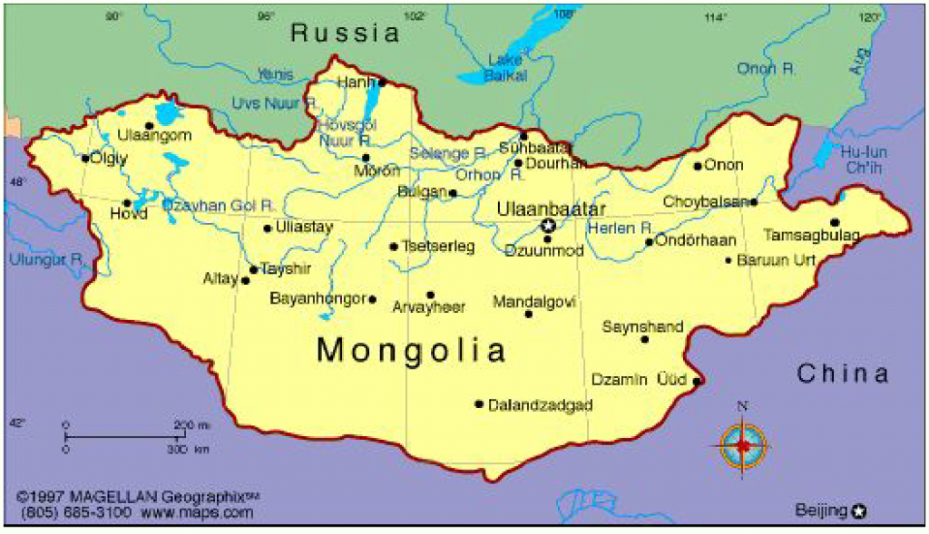
There are currently 21 provinces in Mongolia, with Ulaanbaator the capital city being its own independent autonomous municipality. The capital is also the highest populated area at about 1.4 million people, which is almost half the country’s population.
Map of the city of Ulaanbaator
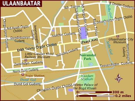
As we can see the capital itself is relatively small and shouldn’t be too difficult to navigate around. You can either fly in via Chinggis Khaan International Airport or by the Trans-Mongolian railway by China or Russia. There are trains from Moscow, Irkutsk, and Ulan-Ude to Ulaanbaator if you’re coming in from Russia. If coming in from China, there are weekly trains from Beijing and the border city of Erlian.
There you have it. If you’re visiting Mongolia, your tour will be based in the capital city of Ulaanbaator. Any other cities you visit will be branched off from this location. But since most people visit Mongolia for its natural beauty, you’ll have the whole country to explore with your local guide. In all honesty, when it comes to independent travel in Mongolia, most foreign tourists base their activities in Ulaanbaator. Safe travels!