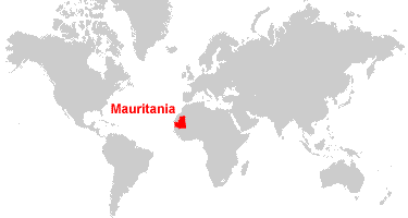
The Islamic Republic of Mauritania is an enormous country in northwestern Africa. Approximately 90% of the nation’s geography lies in the Sahara. The capital city Nouakchott lies on the Atlantic coast. Nouakchott contains about 1/3 of Mauritania’s population of 4 million people. Most of the population resides in the south, where there is more fertile land for agriculture.
Let’s take a look at the geography of the map of Mauritania. In addition, would you want to know why people are traveling to Mauritania? Click here.
Topographic Map of Mauritania

We can see why a larger segment of the population resides in the southern part of Mauritania. The Senegal river flows there and is home to many tropical forests, woodlands, and savannas. The arrow points to the Richat Structure, which is a natural dome known as the “Eye of Africa”.
Cities of Mauritania
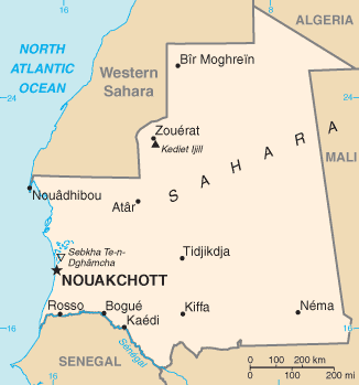
If you ever book an independent Mauritania Tour with Young Pioneer Tours, you’ll visit at least three cities on the above map: Nouakchott, Atar, and Nouadhibou. In addition, you can ride in coal trains across the Sahara in Mauritania.

Unfortunately, finding maps of these cities is pretty challenging. Many of Mauritania’s cities are sparsely populated and without much international development. We also offer tours into neighboring areas in addition to Mauritania, here.
Travelers reading about this part of the world will be attracted to Mauritania’s other worldly feeling. It has been largely untouched by the outside world since the French colonial days; the exception being iron ore mining. If you love traveling off the beaten path, Mauritania will be on your list!
And that is the YPT guide to the map of Mauritania and maps of the various parts of Mauritania. The country is now open for tourism. Check out our Mauritania Independent tours page.