Introduction
Despite being an autonomous region of the Republic of Iraq, Iraqi Kurdistan is part of the much wider Kurdistan region. The Kurdistan region is not a country, but a mountainous area that stretches over large parts of northern Iraq, western Iran and southeast Turkey whilst also covering smaller regions of northeastern Syria and southern Armenia. Some might describe it as an unrecognised country.
Let’s take a look in detail at the map of Iraqi Kurdistan and of the Kurdistan region as a whole.
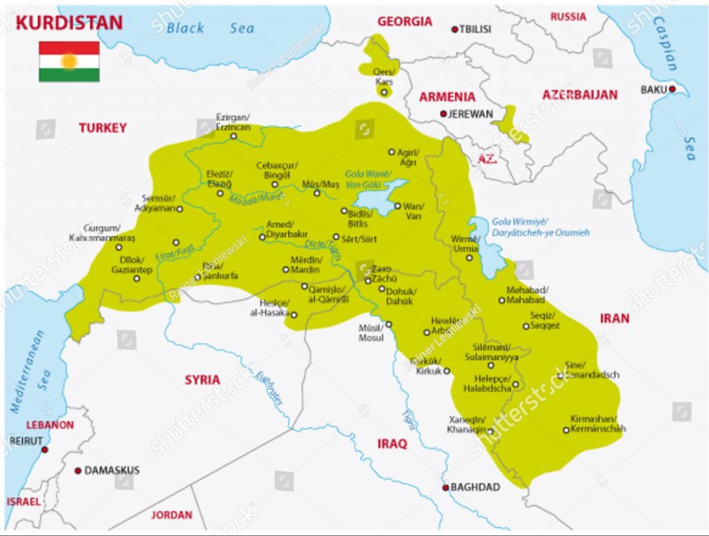
Map of Kurdistan
Kurdistan is an extensive region that is predominant across the Middle East. I could go on forever discussing the various conflicts that have ravaged the region over time – but that’s definitely for another blog!
Between 25 and 35 million Kurds inhabit the region that straddles the borders of Turkey, Iraq, Syria, Iran and Armenia. They make up the fourth-largest ethnic group in the Middle East, but have never obtained a permanent country to settle in. The Kurds are widely recognized to be the largest stateless group in the world.
Kurdistan covers an area of around about 190,000 km², with the biggest cities in the region being Erbil, Diyarbakır and Kermanshah.
The Kurdish population are recognized in both Iraq and Iran, whilst we’ve already established that the Kurds in northern Iraq have successfully obtained autonomous status from the Republic of Iraq. The Kurds in Iran primarily inhabit the Iranian province of Kordestan.
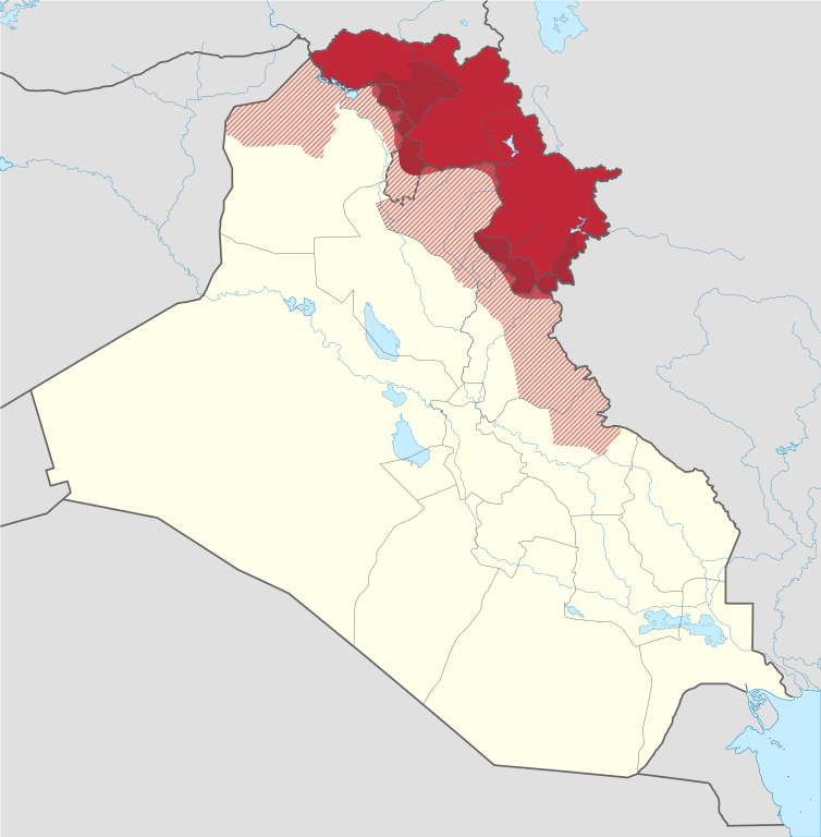
Map of Iraq Kurdistan
Iraqi Kurdistan is an area of Southern Kurdistan that stretches over around 40,000 square kilometres. It occupies the northern part of the Republic of Iraq and is home to 5.1 million people. Iraq Kurdistan gained official autonomous status from the Republic of Iraq in 2007. Its capital city is Erbil which has a population of around a million people from all around the Kurdistan region.
The region is split into four governorates – Dohuk Governorate, Erbil Governorate, Sulemania Governorate and the Halabja Governorate.
The Dohuk region is the north-eastern part of Iraqi Kurdistan, sharing much of its border with Turkey and Syria.
The Erbil region is the central governorate which is home to the capital city of Erbil. The region shares a large border with the Kordestan region of Iran.
The Sulemania region is home to Iraqi Kurdistan’s cultural capital. Sulemania has long been home to the region’s best philosophers, poets and writers. To this day you’ll find plenty of statues and monuments of these famous writers dotted all around Sulmania.
Having split off from Sulaymaniyah Governorate in 2014 and becoming the fourth governorate in Northern Iraq, The Halabja region is the smallest region in Iraq Kurdistan. Halabja is located only 14 km from the Iranian border, making it the closest ‘big city’ to Iran in the region. The city is infrequently visited by tourists, so as such the locals are always pleased to welcome foreigners to their city.
The region continues to grow, and hopefully one day the Kurds will have somewhere they can call their permanent home.
You can read about the differences between Iraq Kurdistan and the Republic of Iraq here.